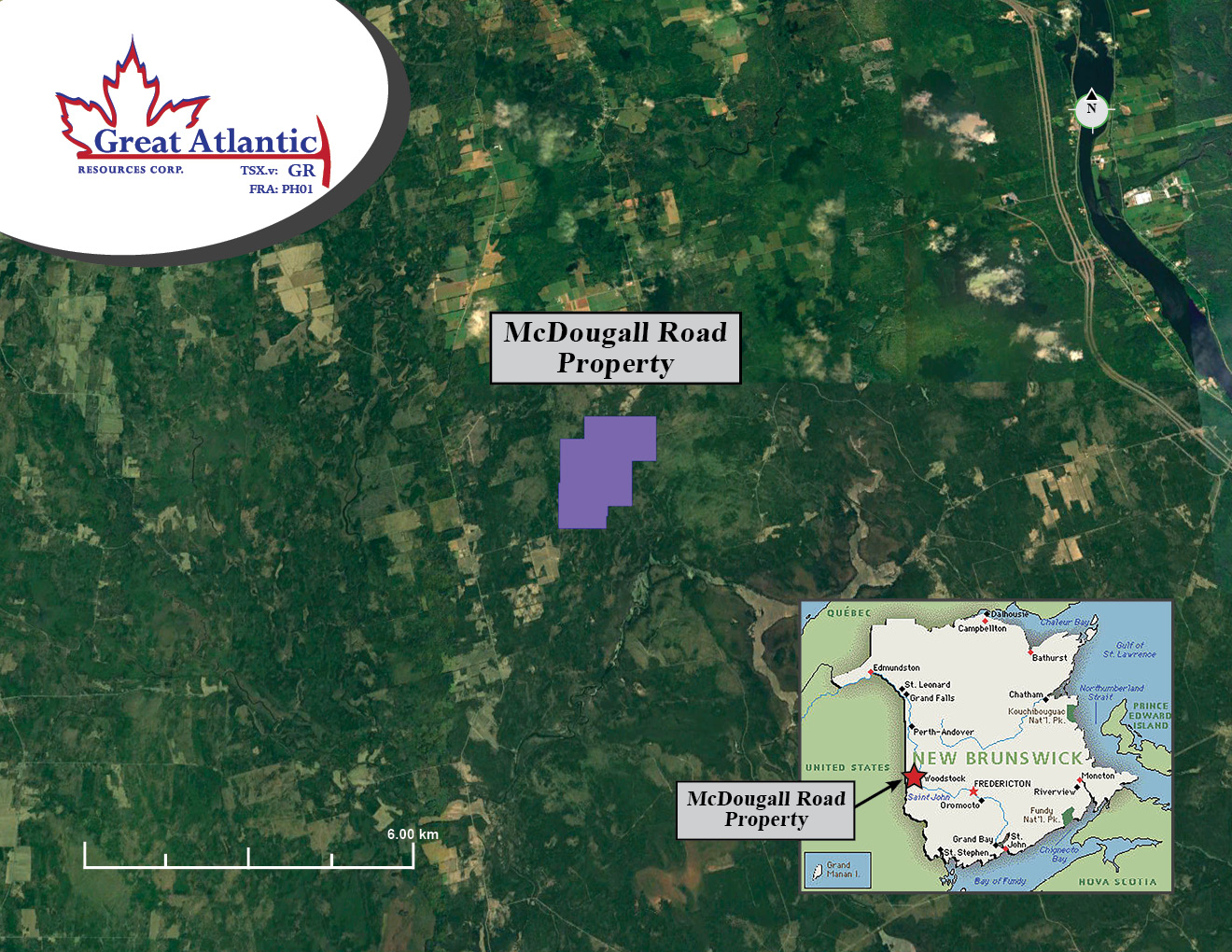
McDougall Road is an antimony - gold property, located in western New
Brunswick. It is an early - stage property covering an area of approximately
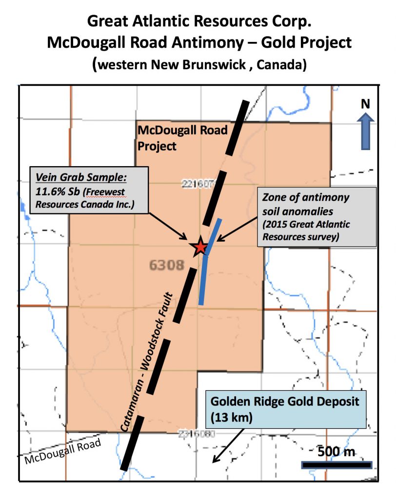
330 hectares. A narrow 12 centimeter wide vein was reported during the
1990s, a sample of which was reported to return 11.6% Sb (source: Freewest
Resources Canada Inc. 1998 Assessment Report on file with the N.B Dept. of
Energy and Resource Development). A qualified Person has not verified the
reported vein / data. Great Atlantic has not been able to locate the reported
vein.
During 2015 - 2016 Great Atlantic identified local antimony soil
geochemical anomalies in the general area of the reported vein with 10% of
the analyzed samples exceeding 5 ppm Sb and a few gold soil anomalies (soil
samples (-180 micron fractions) and lab inserted blank, standard and
duplicate samples being analyzed for antimony by four acid – ICP-MS and for
gold by Fire Assay – AA by ALS Canada in North Vancouver, BC; ALS Minerals is
independent of Great Atlantic Resources). A qualified person has verified this
soil geochemical data through management of the sampling program,
verification of sample data including coordinates and certificate of analysis.
There is no documented diamond drilling in the property. The northeast
trending Catamaran - Woodstock Fault transects the property. The Golden
Ridge* gold deposit occurs approximately 13 km southwest of the McDougall
Road Property, also along the trend of the Catamaran - Woodstock Fault.
*The Company cautions that past results or discoveries on proximate land are not necessarily indicative of the results that may be achieved on the McDougall Road property.